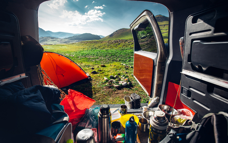
Embracing the Wilderness: Introduction to Scottish Highland Navigation
The Scottish Highlands, with their brooding glens, ancient pinewoods, and endless moorland, offer a landscape both dramatic and untamed—a place where the spirit of adventure is as much a part of the scenery as the heather and the swirling mist. For wild campers, this enchanting region promises solitude and soul-stirring beauty, but it also demands respect and skill when it comes to navigation. Unlike manicured trails found elsewhere, Highland routes are often nothing more than faint tracks lost in a tangle of bracken or barely perceptible lines over wind-scoured summits. Here, the ability to read the land becomes not only a practical necessity but an invitation to truly immerse oneself in its ancient rhythms. The challenge lies in the very nature of the Highlands: weather that shifts without warning, valleys shrouded in cloud, and contours that play tricks on even the most experienced eyes. Yet therein lies the delight—each journey is an exercise in attentiveness and presence, where every decision feels meaningful and every success hard-earned. To navigate here is to engage fully with both the terrain underfoot and the wild heart of Scotland itself, making each wild camping expedition a uniquely rewarding chapter in your outdoor story.
2. Decoding OS Maps: Reading the Landscape Like a Local
There’s something undeniably romantic about unfurling an Ordnance Survey (OS) map on a breezy Highland morning, letting your finger trace the gentle undulations and wild contours of Scotland’s storied land. Yet, to truly wander like a local, you must learn to read these maps with both precision and imagination—each symbol, line, and grid reference whispering secrets of the hills.
Understanding the Basics of OS Maps
British walkers swear by Ordnance Survey maps for their detail and reliability. The most popular for wild camping in the Highlands are the Explorer (1:25,000) and Landranger (1:50,000) series. Explorer maps are especially beloved for their intricate depiction of footpaths, walls, and even isolated bothies—a real treasure trove for those seeking solitude off the beaten track.
Key Map Symbols Every Camper Should Know
The language of OS maps is visual but precise. Here’s a quick guide to some essential symbols:
| Symbol | Meaning | Why It Matters |
|---|---|---|
| Green dashed line | Public footpath | Your invitation to explore legally and safely |
| Brown contour lines | Elevation changes | Read closely to anticipate steep climbs or gentle valleys |
| Blue lines & patches | Streams, rivers, lochs | Vital for water sourcing and scenic camping spots |
| Orange triangles | Trig points (survey pillars) | Often crown summits—superb for panoramic views |
| Black square/rectangle | Shelter or bothy | A rare but welcome sight in stormy weather |
Interpreting Terrain: Reading Between the Lines
The true art lies in reading terrain from paper to reality. Closely packed contour lines mean steep ground; wider spaces indicate gentle slopes or plateaus perfect for pitching a tent. Look for clusters of blue—burns (streams) meander through glens, offering fresh water and lush ground. Moorland appears as a patchwork of pale green and brown; forested sections are deep green swathes that often shelter wildlife.
Navigating with Grid References: Pinpointing Your Place in the Wilds
No British map skill is more empowering than mastering grid references. The OS system uses two letters followed by six digits (e.g., NN123456). The first three numbers give your east-west (easting) position; the next three pinpoint north-south (northing). This system lets you communicate your exact location with pinpoint clarity—a crucial safety net in vast, remote Highland country.
To practice, pick a feature on your map—a loch shore or craggy summit—and read its grid reference aloud. Soon enough, you’ll be able to orient yourself with confidence whether under rolling mist or golden sunset light. With this knowledge, every Highland adventure becomes not just a journey through place but an intimate dialogue with landscape itself.
3. Route Planning: Blending Tradition and Adventure
There is a certain poetry in tracing your route across the Scottish Highlands—where ancient drovers’ paths cut through purple heather, and modern explorers follow the call of wild, unspoilt places. Effective route planning is both an art and a science, balancing tradition with the spirit of adventure. Here’s how to chart your journey wisely, ensuring both safety and serendipity as you wild camp amidst Scotland’s iconic landscapes.
Tips for Plotting Your Path
Start with a trusty Ordnance Survey map—a staple for any Highland wanderer. Use it to identify well-loved trails like the West Highland Way or Cape Wrath Trail, which offer reliable waymarks and a sense of camaraderie among fellow walkers. Don’t shy away from lesser-known routes either; local footpaths winding through Glen Etive or along the shores of Loch Maree can gift you with solitude and unexpected beauty. Mark key features: water sources, possible camping spots, and bothies (those rustic Highland shelters steeped in history).
Weather and Daylight Considerations
The Highlands’ weather is as changeable as the light on Ben Nevis—sunshine one moment, mist and rain the next. Always check the Met Office forecast before setting out, but be prepared for surprises. Keep an eye on daylight hours, especially outside midsummer; dusk falls swiftly in autumn and winter, painting the hills with golden shadows but shortening your walking window. Plan conservatively so you’re not pitching camp by torchlight or navigating boggy ground after dark.
Respecting Local Access Rights
Scotland’s right to roam is a privilege cherished by locals and visitors alike. Follow the Scottish Outdoor Access Code: leave no trace, avoid disturbing livestock or wildlife, and camp discreetly out of sight from roads or homes. Always close gates behind you, and greet those you meet with a friendly ‘hiya’—a small kindness that opens doors in Highland communities.
Discovering Hidden Gems
Beyond guidebook favourites, seek out secret corners: perhaps a forgotten glen where deer graze at sunrise, or an old shieling high above Loch Ness where silence reigns. Chat with locals in village shops or bothies—they may just tip you off to a waterfall or viewpoint that doesn’t appear on any map. In this way, your journey through the Highlands becomes not just about reaching destinations, but about embracing the wonder between them.
4. Digital Companions: GPS Devices and Smartphone Navigation
In the boundless stretches of the Scottish Highlands, where heather sweeps across moors and mist curls over craggy peaks, digital navigation can be both a modern blessing and a subtle hazard. While paper maps hold their timeless charm, GPS gadgets and smartphones have become steadfast companions for wild campers navigating this untamed landscape. Yet, as with all technology, there are nuances to consider in the wilds of Scotland.
Weighing Up the Benefits and Pitfalls
GPS devices offer pinpoint accuracy and real-time tracking—especially useful when weather rolls in or trails vanish beneath bracken. Smartphones, meanwhile, consolidate navigation with photography and communication. However, both can falter: batteries drain rapidly in cold Highland winds, signals flicker in remote glens, and the lure of screens may distract from your natural surroundings.
| Device Type | Strengths | Pitfalls |
|---|---|---|
| Dedicated GPS Device | Robust build, long battery life, precise navigation even off-grid | Heavier than phones, requires learning specific interfaces |
| Smartphone with UK Apps | Lightweight, multi-functional, access to premium mapping apps like OS Maps | Shorter battery life, vulnerable to weather damage, reliant on pre-downloaded maps |
Recommended UK Navigation Apps for Wild Campers
- OS Maps: The gold standard for British outdoor navigation, offering detailed Ordnance Survey mapping offline.
- ViewRanger: Favoured for its intuitive route planning and augmented reality features—ideal for visualising peaks and paths.
- Komoot: Excellent for plotting custom routes tailored to hiking difficulty and scenic interest across the UK.
- What3Words: Perfect for pinpointing precise locations in emergencies or rendezvousing with friends amidst the lochs and bens.
Keeping Your Tech Alive in the Elements
The Highlands’ weather is famously fickle—rain lashes sideways one moment; sunshine gilds the hills the next. To ensure your devices keep pace with your journey:
- Pre-load maps offline: Signal is patchy at best; download routes before you set out.
- Cherish your battery: Keep devices on flight mode when not actively navigating and bring a robust power bank (ideally 10,000mAh or more).
- Shelter electronics: Use waterproof cases or dry bags; condensation is as much an enemy as rain.
- Diversify your toolkit: Always pair digital navigation with a physical map and compass—a Highland essential should tech fail you amidst swirling fog or sudden downpour.
A Balanced Approach for Modern Explorers
The digital age brings both comfort and caution to wild camping in Scotland’s high places. Embrace technology’s guidance but let it complement—not replace—the art of reading the land by eye and heart. In this synergy lies both safety and adventure, ensuring your Highland sojourn is guided by both innovation and instinct.
5. Staying Safe and Savvy: Navigational Etiquette and Emergency Tips
As you wander into the untamed beauty of the Scottish Highlands, safety and responsibility must be your steadfast companions. Beyond the thrill of exploration, wild campers are custodians of these ancient landscapes, carrying the duty to tread lightly and wisely. Here are essential reminders to ensure both your safety and the preservation of this wild haven.
Embracing Leave No Trace Principles
The Highlands whisper their stories through mossy glens, shimmering lochs, and windswept moors—treat them with respect. Adhere strictly to Leave No Trace principles: pack out all rubbish, minimise campfire impacts (better yet, use a portable stove), and avoid disturbing wildlife or trampling fragile flora. Choose established paths where possible and camp on durable ground, leaving each place as untouched as when you arrived.
Navigating Sudden Scottish Weather Changes
Scottish weather is famously mercurial—a sunlit morning can swiftly turn to a mist-shrouded afternoon. Always check forecasts before setting out, but prepare for unpredictability by packing waterproofs, thermal layers, and extra provisions. Keep your map and compass accessible even if you’re relying on GPS; dense fog or sudden rain can quickly disorientate even seasoned hillwalkers. Remember, a bothy or emergency shelter can provide vital refuge in exposed conditions.
What to Do If You Become Disoriented
If you find yourself unsure of your location, pause and resist the urge to press on blindly. Reassess using your map and compass; retrace your steps if necessary to a known point. If visibility is poor or night is falling, it’s often safer to stay put—signal for help using a whistle (six blasts at ten-second intervals) or your phone’s emergency services function if signal allows. Let someone know your route in advance, so rescuers have a starting point should assistance be needed.
With respect for nature’s rhythms and a mindful approach to navigation, wild camping in the Highlands transforms from mere adventure into an act of harmonious belonging—a way to cherish Scotland’s wild heart while keeping yourself safe amid its dramatic embrace.
6. A Highland State of Mind: The Art of Slow Navigation
To truly navigate the Scottish Highlands is to embrace a pace attuned to the landscape itself. Beyond the practicality of map reading and GPS, there lies a deeper art—one that invites you to slow your stride, lift your gaze from the compass, and allow the spirit of place to seep into your journey.
Mindful Travel in the Highlands
Wandering these ancient glens and rugged moors is not merely about reaching the next waypoint. Instead, it’s an invitation to tune in: to the whisper of wind over heather, the distant call of curlews, and the shifting light across mountain lochs. As you plot your course, take time to pause. Let each stop become a quiet celebration—a flask of tea sipped on a mossy stone, or a moment standing still as mist curls around Ben Nevis’ slopes.
The Pleasures of Pausing
There’s a unique pleasure in lingering where map contours soften into shadowy hills and rivers carve silver threads through the land. These pauses enrich your route planning; they offer spaces for reflection and foster a profound appreciation for the wild beauty surrounding you. Consider marking scenic lookouts or tranquil glades on your map—not just as navigational points, but as opportunities to connect with the Highlands’ storied soul.
Navigating with a Sense of Place
To navigate here is to build a relationship with place. Allow local tales, Gaelic names, and ancient paths to guide not only your feet but also your imagination. Whether following an old drover’s track or using Ordnance Survey maps alongside GPS, let each tool enhance—not replace—your sense of wonder and presence. In this way, navigation becomes more than wayfinding; it transforms into an experience of belonging within Scotland’s wild heart.
As you venture through the Highlands, remember: slow navigation is not a luxury but a means to travel well. So linger longer at every turn, breathe deeply, and let each Highland mile shape both your route and your memory.